
Archaeologist and aerial photographer
The Zagora Archaeological Project embraces new technology. Not only is our data being recorded into the database system HEURIST using digital tablets but in 2014 a new technology was utilised at the site: Unmanned Aerial Vehicles, or UAVs.
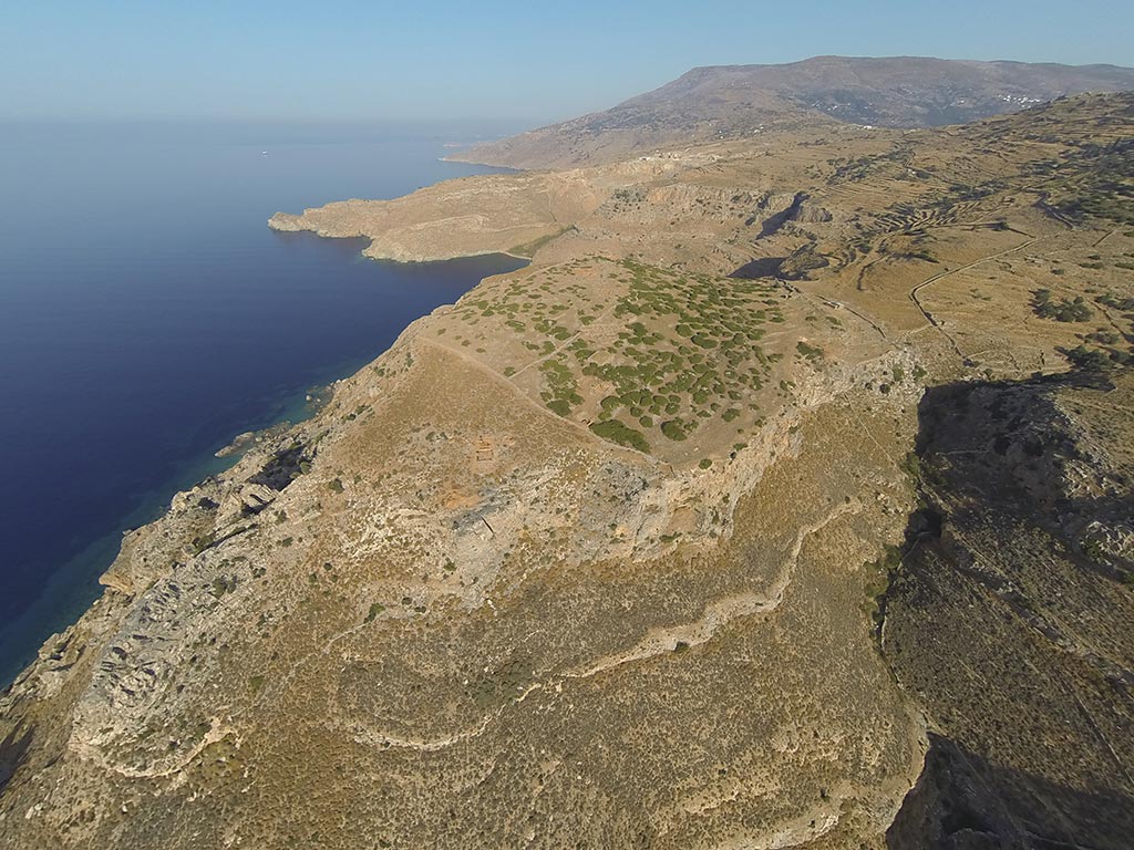
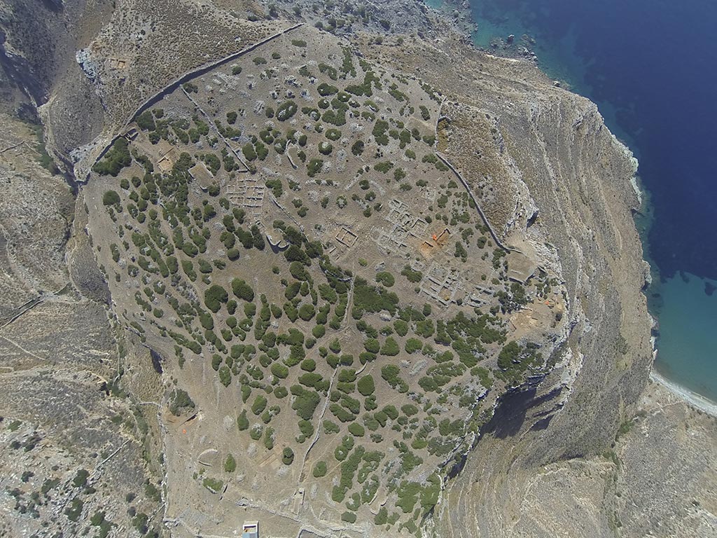
The first aerial photograph of an archaeological site was taken by Friedrich Stoltze of Persepolis in 1879. The decision to aim a camera at an archaeological site from the air had a lasting impact on archaeological recording. Aerial photography is visually attractive but it is also an important recording technique. It provides archaeologists with another view of a feature that can be useful to help understand large archaeological remains as a whole. Not only can aerial photographs assist in recording a site, it can also help illustrate the wider environment that the site is situated in. For example, photos of Zagora help illustrate its position on the coastline and its relationship with the nearby mountains.
If you read this blog in 2013, you may remember that both Adam Carr and I were using kites to take aerial photographs of the site, specifically of trenches. At the time, this was our first real foray into the world of aerial photography. The practice itself was incredibly interesting, although fraught with issues. Many days of the dig were either too windy or, surprisingly for Zagora, not windy enough. Launching the kite and attaching the camera could take up to an hour and aligning the camera over a target was often a guessing game as we couldn’t see what the camera was shooting.
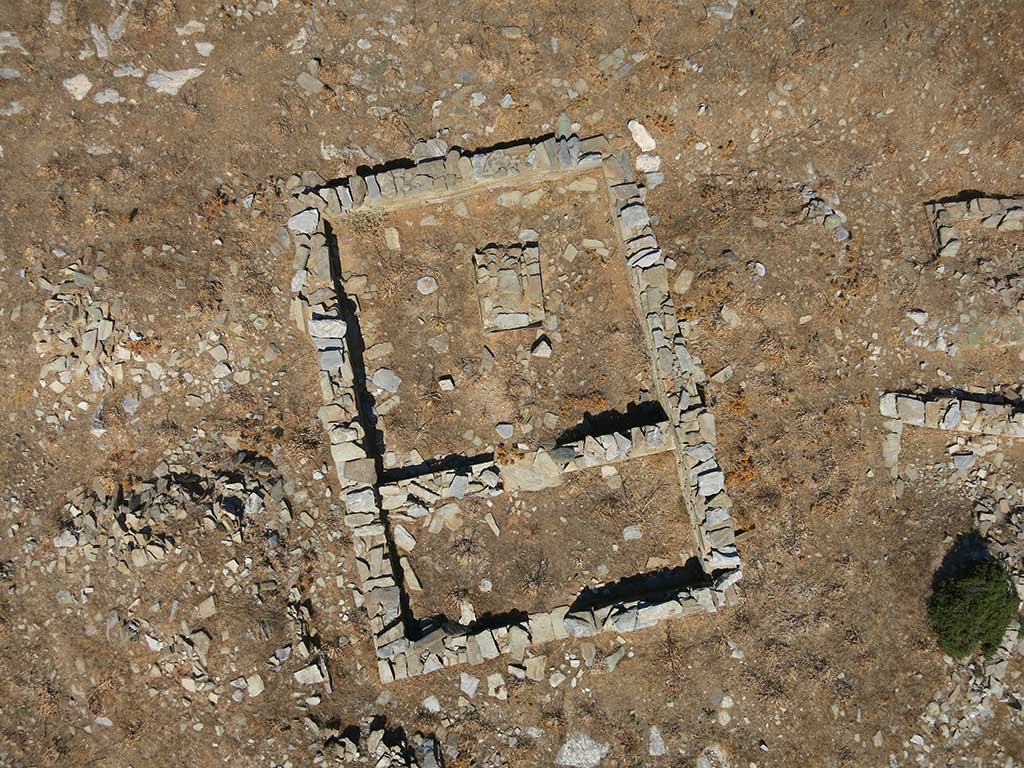
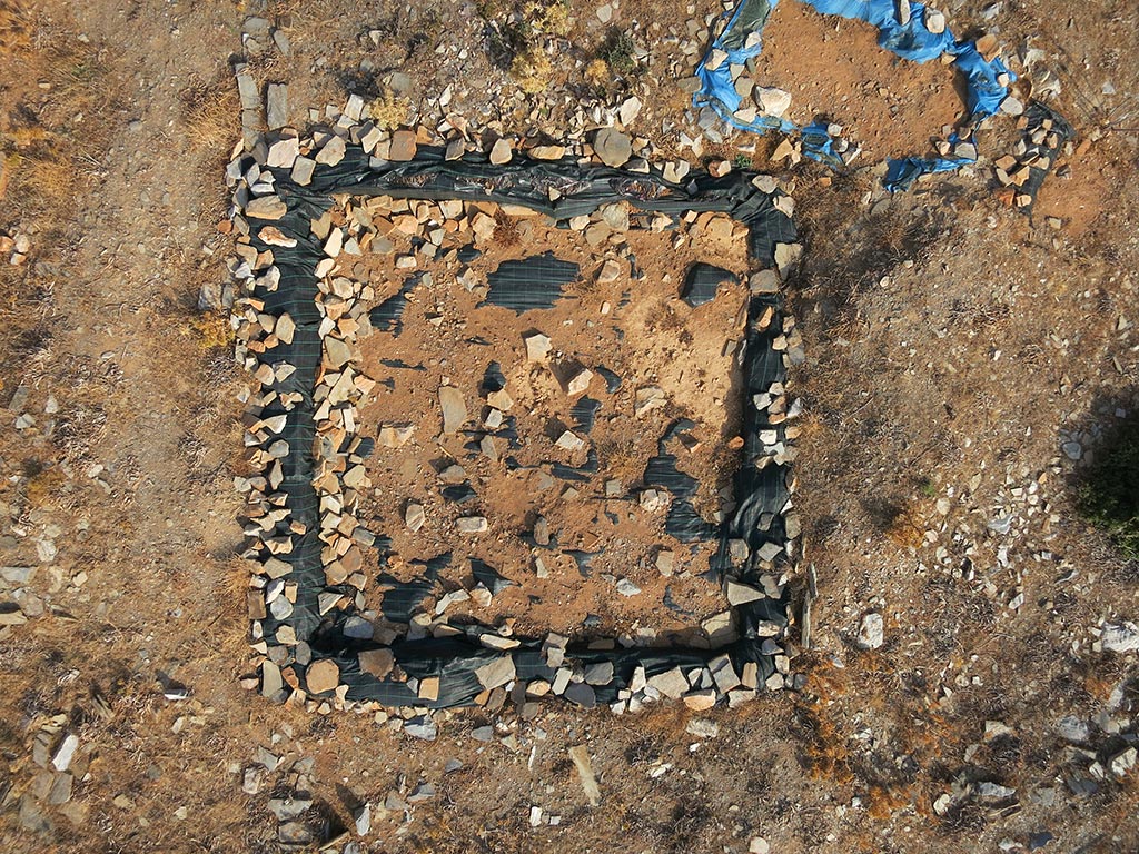
That being said, the photographs we took in 2013 became an important record about the excavation of the site. Furthermore, we were lucky that many of the photographs were beautiful.
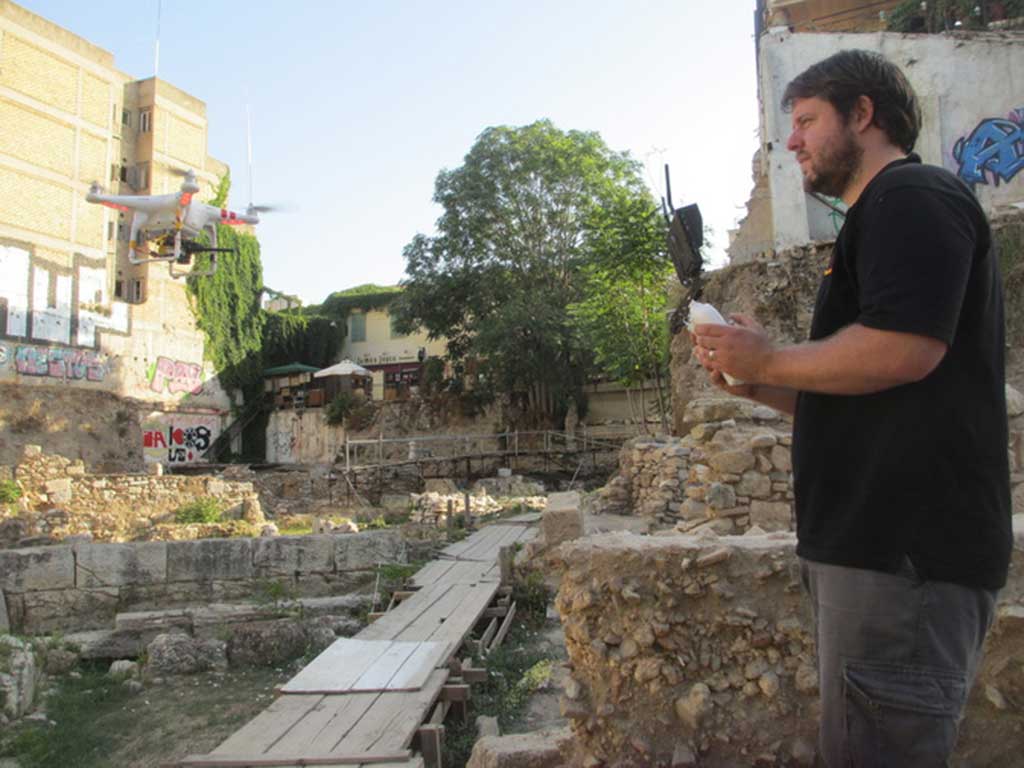
Zagora started my love of aerial photography and I was hooked. On my return home, I began to research other forms of aerial photography. I even went to the step of starting my own little business. In the time between the Zagora 2013 and 2014 seasons, I performed aerial photography not only in Australia, but I have also taken aerial photographs of several sites in Crete, the Agora in Athens and for the archaeological project of Methone in northern Greece.
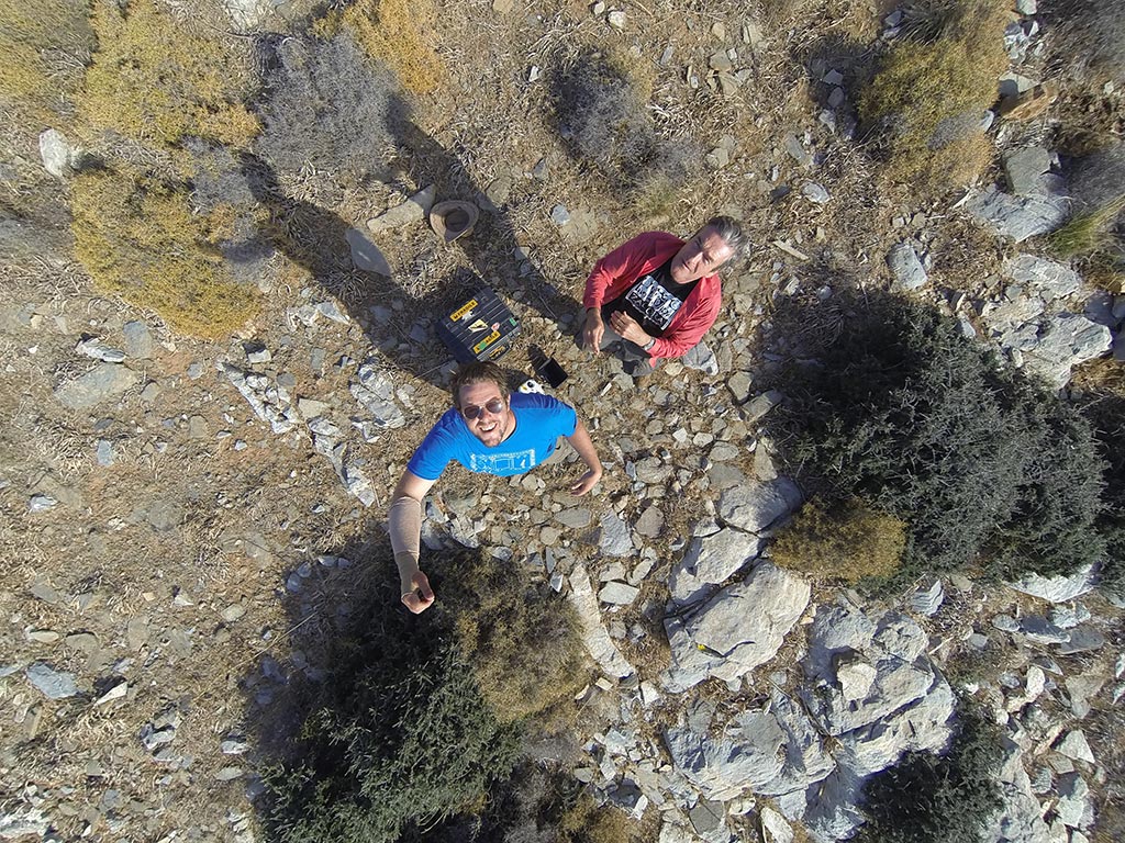
In 2014 at Zagora I came back not only as a trench supervisor but also as the site’s aerial photographer. However, instead of kites, I used a drone!
The drone I used for aerial photography was the DJI Phantom 2. This small quadcopter weighs approximately 1kg and has a maximum payload of approximately 400 grams. There are larger hex and octocopters which can carry DSLR cameras, but these drones are both much heavier and difficult to transport, have greatly reduced flight times, around 5-7 minutes, and often cost at least $5000-10000. In comparison, the DJI phantom retails around $1000, is much lighter, and can fly about 15-25 minutes, with my average flight time around 17-19 minutes. Also for sites such as Zagora, which are well off the beaten track, taking a 10kg pelican case with all the gear required is much better than taking a 15-20kg case.
My drone was outfitted with a custom made, 3D printed jello-resistant mount (stops the vibrations from the propellers) which allowed the attachment of a Canon S110 camera, the exact same camera used in 2013 for the kite photography. The drone also carried a Boschom wireless video transmitter, which was connected to the Canon by a home made USB video out cable. This allowed a live video stream of the camera’s field of view to be watched on the ground by the pilot. Finally, the drone carried an IOSD mini, a device which allows live telemetry data to be viewed through the video stream. This device is crucial for measuring the altitude of the drone, allowing the pilot to photograph the site from approximately the same height over multiple sessions.
Using a drone requires a lot less set-up time than kite photography, around 5 minutes from opening the case to photographing, in comparison to around 30 minutes to an hour for kite photography. But arguably the greatest aspect of the use of drones for aerial photography is the stability of the platform. Once located over an area, most modern drones use GPS to hold themselves within a plane of a few metres horizontally and one metre vertically. This results in more photographs being on target and with the addition of the first person view system easily allows the pilot to make small corrections to the drone.

Unfortunately, the drone is limited to flying in relatively calm weather conditions (Under 35 km/h) but this wind speed is theoretically the most our small kite from last year could have handled. That being said, on the last day of excavations I sent the quadcopter up in winds exceeding this. The little drone’s sensors sensed the winds were too strong and it began to wildly flash its lights telling me to land it, but it managed to still fly and allow me to take the end of season’s photographs. It was not a pleasant flight, especially with thousands of dollars worth of equipment a strong wind gust away from flying off into the distance!
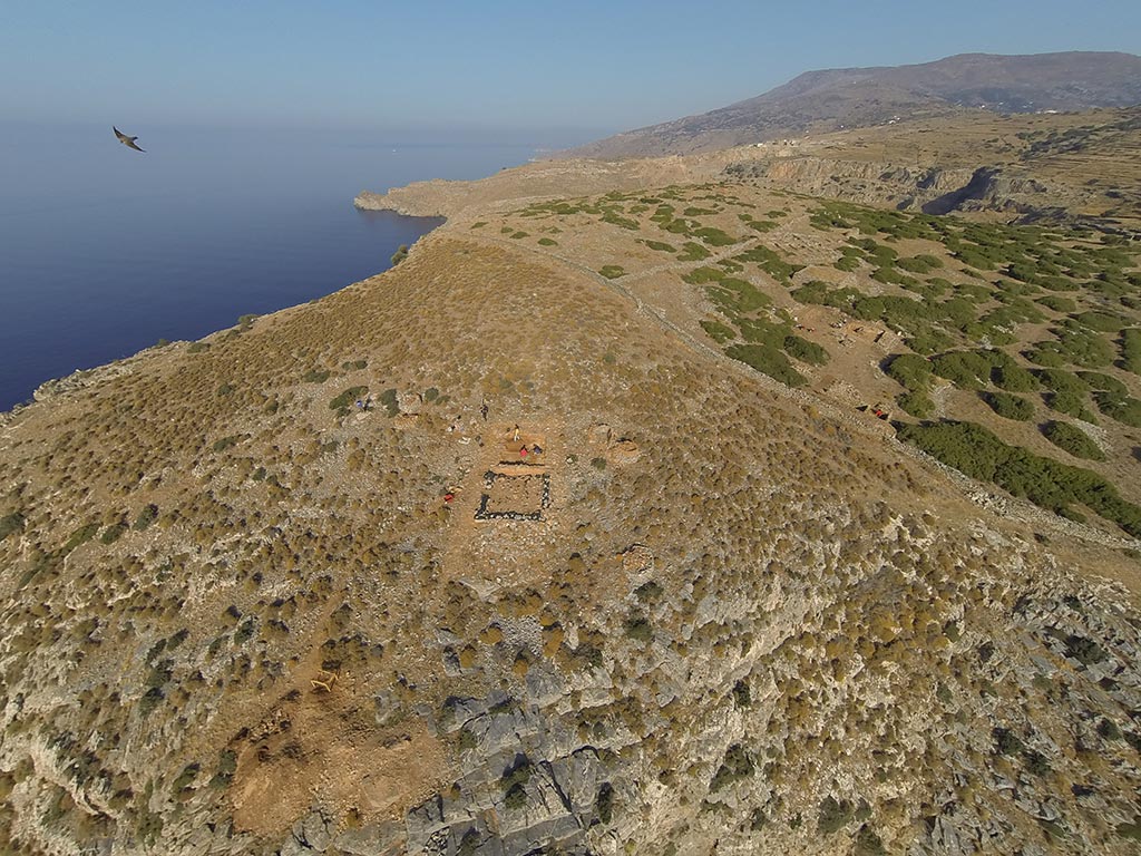
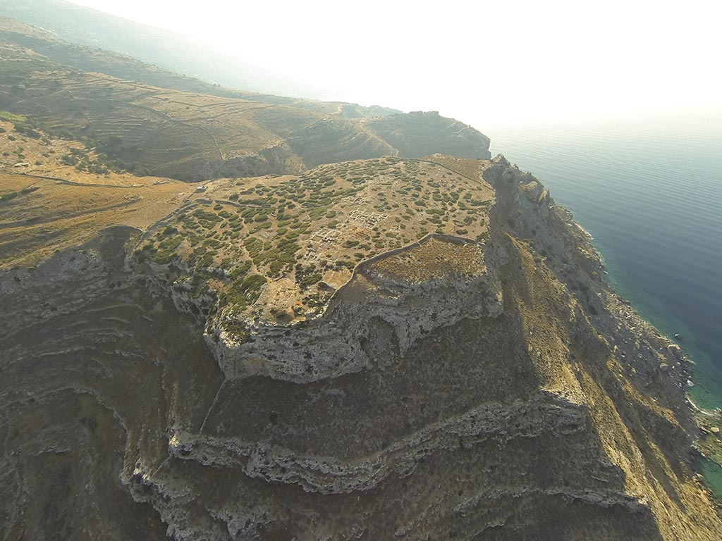
Arguably my most favourite flying session was midway through the project and demonstrates one feature mentioned previously, visualising the site within the wider environment. On a very still day, I put on a GoPro camera and sent the drone as high and far as I could – some 150m horizontal distance and 150m high. It provided views of the site that are rarely seen and helps show the site as a whole, something that is quite rare with a site so big. It provided an amazing view of the site. As someone said afterwards, it’s not only important archaeologically; it shows how beautiful the site is.
Using drones is one of the new and important technological leaps that archaeological projects are making. It was such an amazing experience to be able to shoot the site from the air using this new technology. Not only are the photos going to assist the project, it will give me a memento of my long time working on such a wonderful site.
1 thought on “Aerial (quadcopter) photography of Zagora in 2014”
This is absolutely brilliant! – it really shows how lovely the site is and how the structures all fit together! Excellent work!